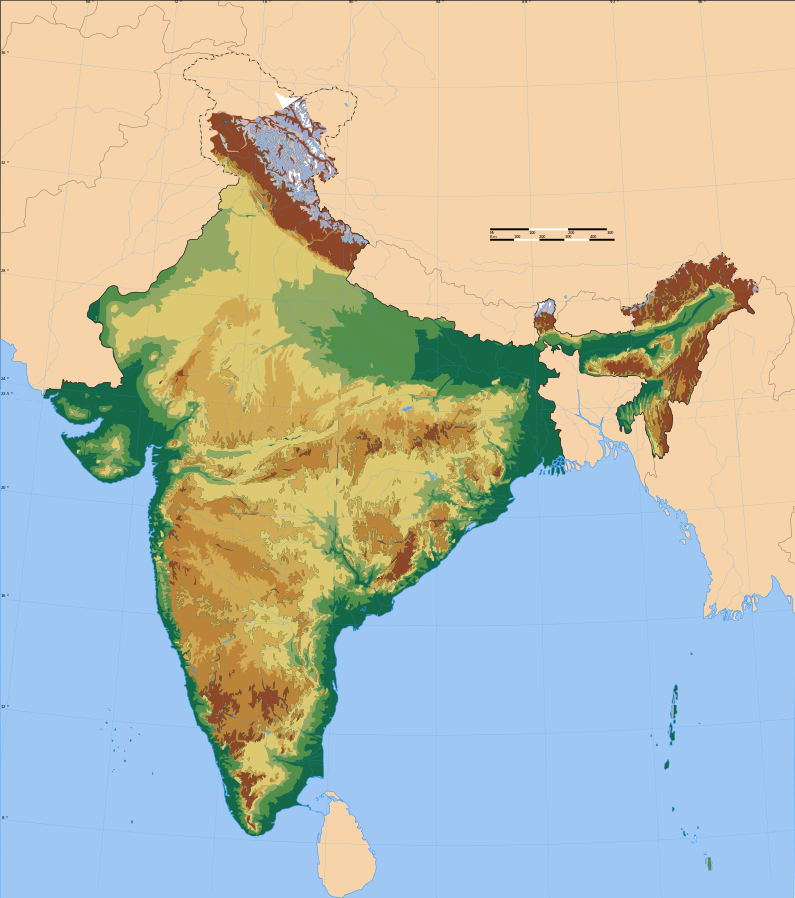
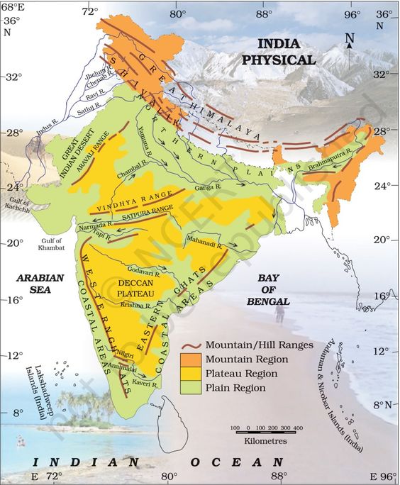
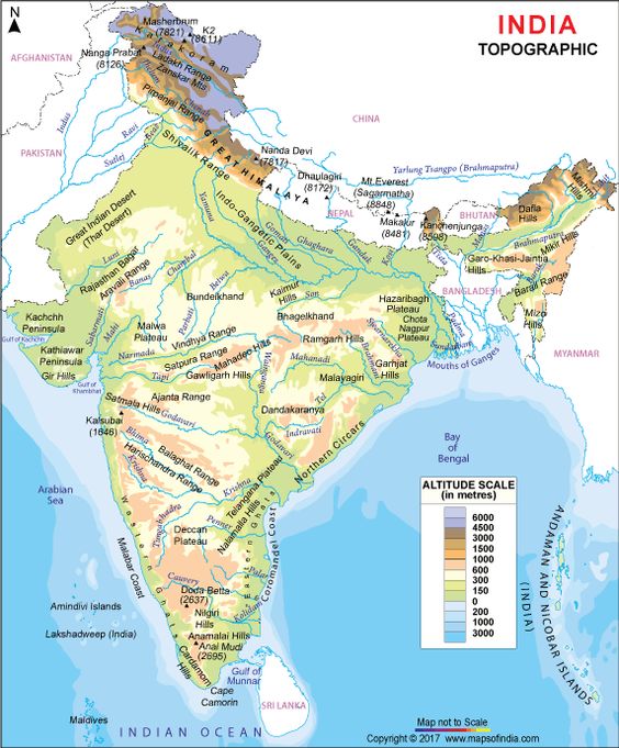
Detail about India Physical Map
A physical map of India shows all the physical divisions of the seventh-largest country in the world. The topographical features of the country are quite varied. These high quality and informative maps help you understand all the topographical features of India. The country is home to snow-clad mountains, hills, vast green plains, deserts, forests, rivers, plateaus and seashores. There is no physical feature that you will not find in India.
A physical map of India is always a helpful guide for the students, tutors and parents. They can download this map as a printable or offline version and use it for map pointing purposes. This will help them enhance their knowledge about the physical features of India. With the help of the India physical map, they can easily locate the following areas or physiographic regions in the country:
- The Himalayan Mountain Range (the highest range of mountains in the globe)
- The Indian Peninsula
- The Indo Gangetic Plains
- The Great Indian Thar Desert
- The Western and Eastern Ghat Mountain Ranges
- The Karakoram Mountain Range